Nim Li Punit
Nim Li Punit
A Maya archaeological site in Toledo District, Nim Li Punit preserves the tallest stela in Belize and a museum showcasing artifacts from excavations.
Built on a ridge 220 feet above sea level in the foothills of the Maya Mountains, Nim Li Punit is an archaeological site located near Indian Creek Village in Toledo District in southern Belize. The ancient city stands out for its carved stelae, including the tallest ever discovered in Belize, and a visitor center overlooking the coastal plains.
Why visit Nim Li Punit
Nim Li Punit remains less crowded than Caracol or Xunantunich, making it an ideal quiet stop for those seeking to understand Maya civilization without the masses. The concentration of ornate stelae, the quality of the visitor center museum, and the panoramic views over southern Belize's foothills justify the detour. Plan for 1 to 2 hours to explore the three complexes and the exhibition.
Site history
Origin of the name
The ancient city's original name remains unknown. Nim Li Punit, in the Kekchi Maya language, means "the great hat," which also gave rise to the names Big Hat and Top Hat. The name refers to the imposing headdress of a ruler depicted on one of the site's stelae.
Discovery and excavations
The site was discovered in 1976 by petroleum prospectors. The first excavations were conducted by archaeologist Norman Hammond, who created the initial mapping. Research has continued since: the 2015 campaign yielded several clay pots and a carved jade pectoral, now displayed on site.
Peak and decline
Nim Li Punit was occupied between the 5th and 8th centuries CE. Its peak occurred between 721 and 790 CE, before decline began in the 9th century. The population, estimated at 5,000 to 7,000 inhabitants, largely descended from Maya groups that migrated from Guatemala and spoke Cholan, the language of central Maya peoples. Its position made it an active commercial hub, notably linked to Tikal in Guatemala and Copán in Honduras, as well as the nearby site of Lubaantun.
What to see
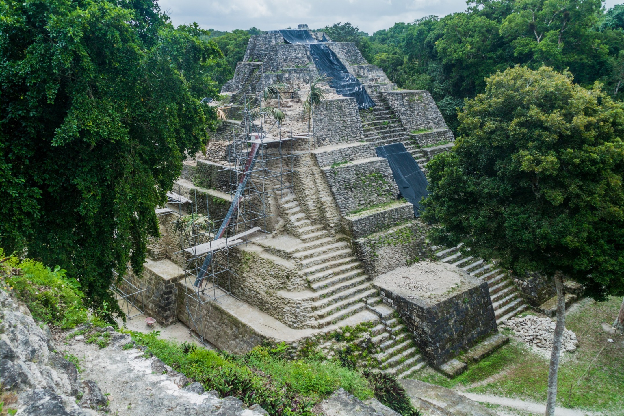
The site is organized into three complexes arranged around cleared plazas: south, west, and east. The vegetation is dense and the ruins, partially covered with moss, retain a minimally restored appearance.
- South complex: 26 stelae, 8 of which are adorned with effigies of rulers, plus the Plaza of Royal Tombs, dominated by a 12-meter-high structure and surrounded by palatial buildings.
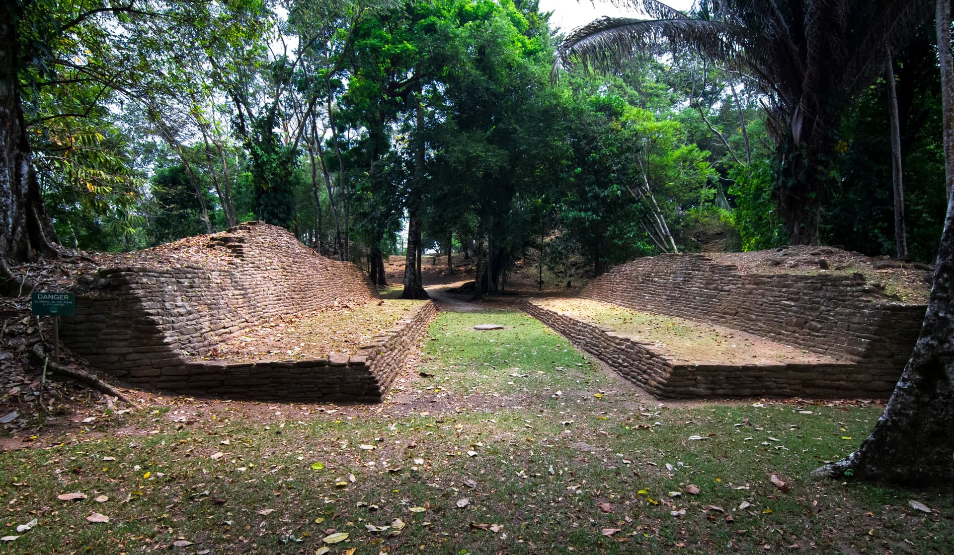
- Ball court: situated between the south and east complexes, with a central marker still in place.
- East complex: a group of structures associated with astronomical observations.
- West complex: set back, organized around a two-level terrace.
Stela 14
The site's masterpiece, Stela 14 measures approximately 30 feet, or nearly 9.5 meters. It is the tallest stela ever discovered in Belize and the second tallest ever recorded at any Maya site. Its surface is carved with detailed motifs depicting a ruler in an elaborate headdress.
The visitor center and museum
Comprising two buildings at the site entrance, the visitor center houses a small museum displaying artifacts from excavations: ceramics, jade, and stelae moved for conservation. From its terrace, views extend across the coastal plains of southern Belize.
Practical information
- Duration of visit: 1 to 2 hours including the museum.
- Hours: open daily during daylight hours. Verify current hours with the Institute of Archaeology of Belize before your visit.
- Admission: moderate entrance fee, with reduced rates for Belizean nationals.
- Parking: available near the visitor center.
- What to bring: water, closed-toe shoes, insect repellent, and a hat. The trail remains accessible but can be slippery after rain.
When to visit
The site can be visited year-round. The dry season, from late December to April, offers the best conditions: passable trails and better visibility from the visitor center's viewpoint. During the rainy season (June to November), afternoon showers are frequent and vegetation may render some paths muddy. A morning visit helps avoid the strongest heat.
How to get there
Nim Li Punit is located approximately 95 miles from Belmopan, the capital. From Belmopan, take the Hummingbird Highway heading south, then turn onto the Southern Highway toward Indian Creek Village. A winding gravel road then leads to the site entrance. Plan for approximately 2.5 to 3 hours of driving in total. The site is also accessible from Punta Gorda, the nearest town to the south.
Nearby attractions
Several other Maya sites and natural areas in Belize lend themselves to a complementary itinerary:
- The Caracol Maya ruins, one of the country's most expansive archaeological complexes.
- The archaeological site of Yaxha, near the Guatemalan border.
- The Mountain Pine Ridge Forest Reserve, for its pine landscapes and waterfalls.
- The Agua Caliente Natural Reserve, in Toledo District, for its wetland ecosystem.
Frequently asked questions
Frequently asked questions
The phrase means "the great hat" in Kekchi Maya language. It refers to the imposing headdress of a ruler depicted on one of the site's stelae, which also gave the place the nicknames Big Hat and Top Hat.
Allow 1 to 2 hours to explore the three complexes, observe Stela 14, and visit the visitor center museum.
Yes. The site is modest in size, trails remain passable, and the museum offers an accessible introduction to Maya history. Bring water and protection from sun and insects.
Yes. Lubaantun, also located in Toledo District, can be visited the same day. Further north, Caracol and Yaxha complement a circuit dedicated to Maya civilization.
Planning your trip
Nim Li Punit integrates easily into an itinerary in southern Belize, combining Maya archaeology, jungle, and Caribbean coast. To build a custom itinerary incorporating this site and other country highlights, explore our Belize travel packages.
Interested in this visit?
We can include it in your personalised itinerary.