North and Lamanai
Sugarcane plains, Ramsar lagoons and boat-accessible Maya sites: northern Belize moves to the slow rhythm of the New River and herons.
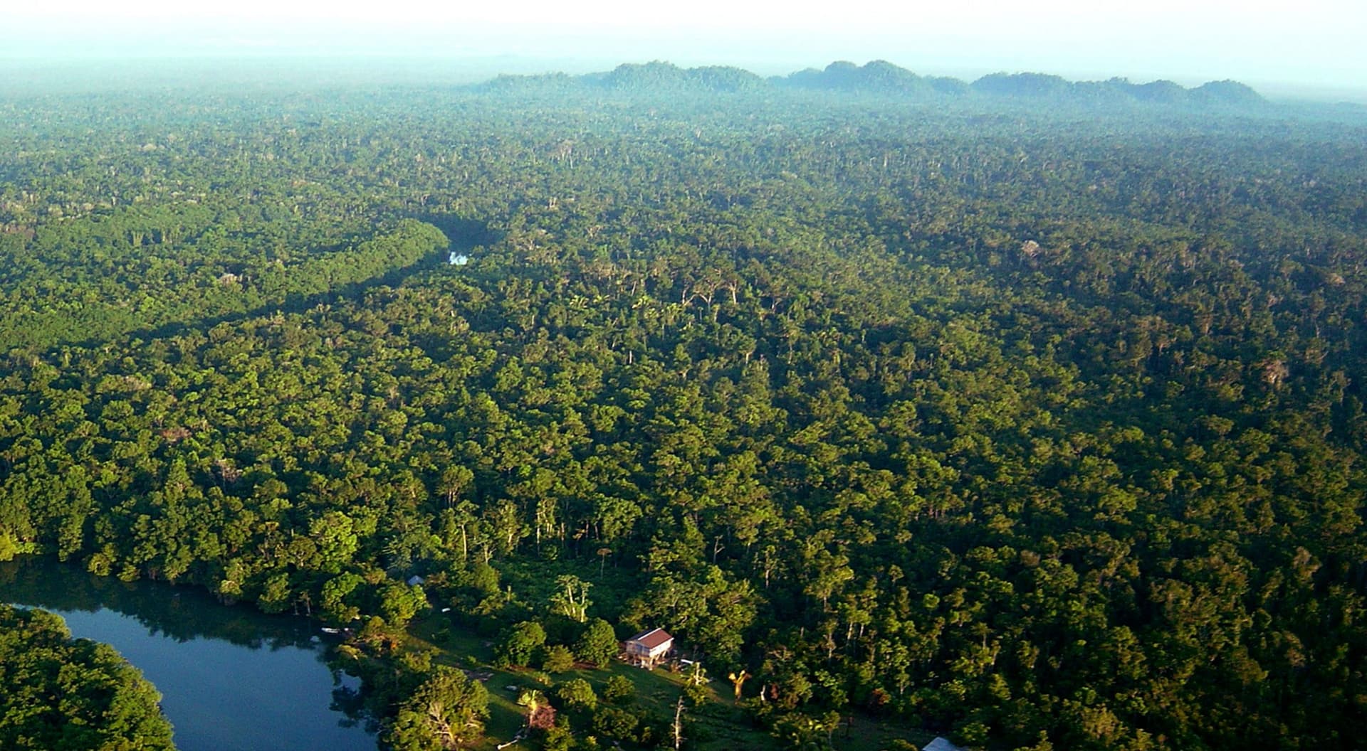
Northern Belize stretches from the sugarcane plains of Orange Walk to the Mexican border at Corozal, across roughly a hundred kilometres of lowlands crossed by two slow rivers: the New River and the Rio Hondo. It is a region of virtually nil altitude, rarely exceeding 50 metres, where limestone outcrops beneath a mosaic of secondary forests, seasonal marshes and cultivated fields. The climate here is drier than in the south of the country, with a shorter rainy season, which partly explains the historical significance of human settlement in the area.
Orange Walk, nicknamed Sugar City, pulses to the rhythm of sugarcane harvesting between December and June. Trucks laden with cane circulate day and night toward the Tower Hill refinery. The population blends Mestizos descended from refugees of the Yucatán Caste War in the 19th century, Mennonite communities from Blue Creek and Shipyard who cultivate maize and soya in straw hats and horse-drawn carts, and Creoles settled along the river. Corozal, further north, is dominated by Yucatecan influence: Spanish is spoken as much as English, and the cuisine draws from neighbouring Mexico, with panuchos, salbutes, and escabeche of chicken with pickled red onions.
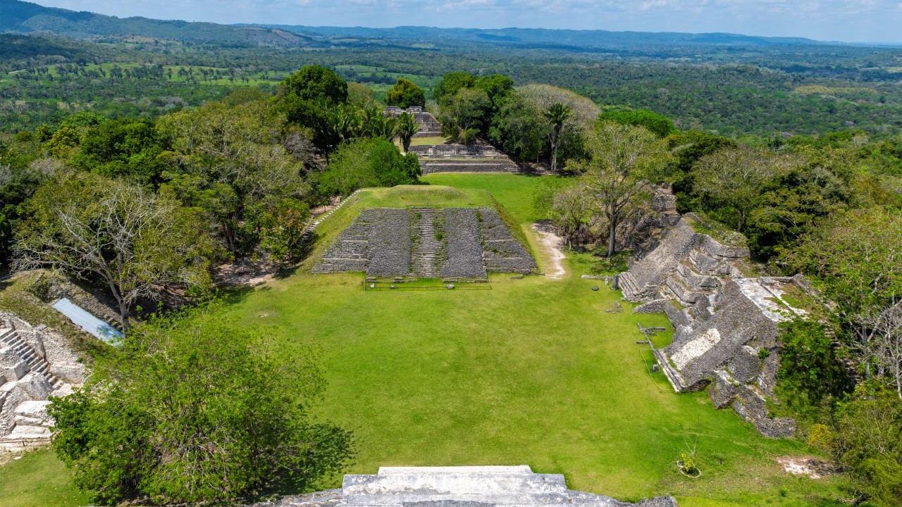
The Maya site of Lamanai serves as the anchor point of our programme in the region. Its name means submerged crocodile in Maya Yucatec, referring to the Morelet's crocodiles that still populate the adjacent lagoon. Lamanai presents a particularity that few Maya sites share: continuous occupation from 1500 BCE until the arrival of the Spanish in the 16th century, more than three thousand years. You can see the ruins of two Franciscan churches built atop pre-Hispanic structures, then torched during an indigenous rebellion. The Mask Temple, the High Temple rising 33 metres above the canopy, and the Jaguar Temple mark a path through the undergrowth where black howler monkeys roar.
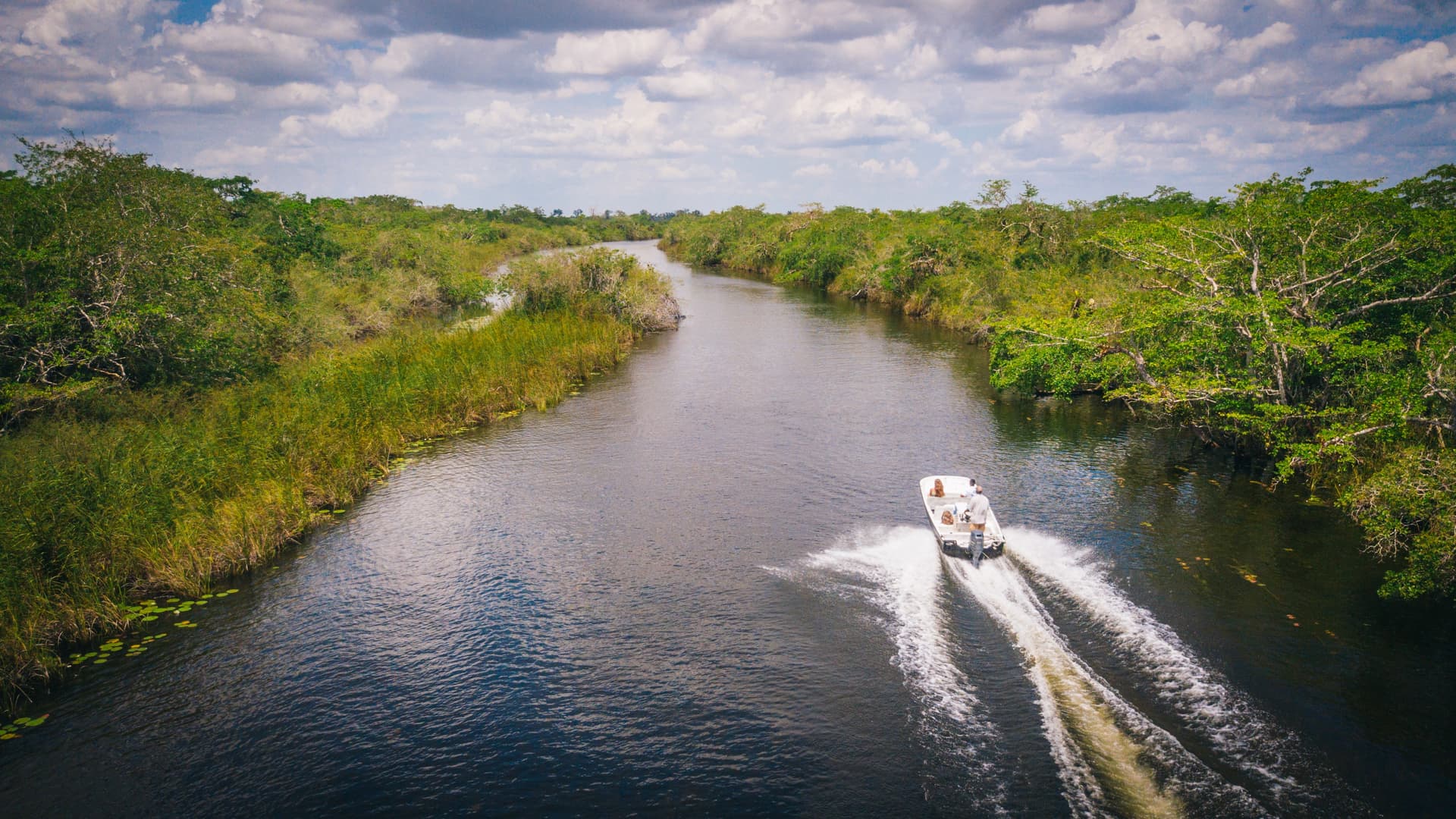
Access to Lamanai is by boat from Tower Hill Bridge, south of Orange Walk. The journey upstream on the New River takes roughly an hour and a half. The pilot slows at spots where crocodiles bask on the banks, where jacanas walk on water lilies, where anhingas dry their wings on dead branches. You may glimpse fishing bats hanging beneath leaning trunks. This river approach is integral to the archaeological experience: this river was how the Maya themselves accessed the site.
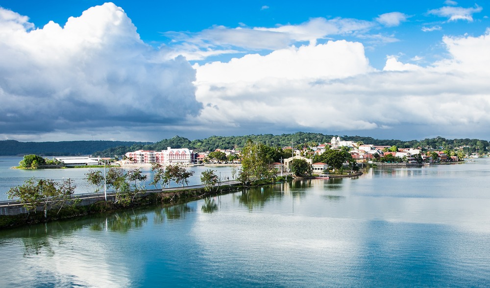
The other natural hub of the north, Crooked Tree Wildlife Sanctuary, is a 16,400-hectare wetland designated a Ramsar site since 1998. The village of Crooked Tree, one of the oldest Creole settlements in the country, sits on an island connected to the mainland by a submersible causeway. The lagoon attracts concentrations of water birds during the dry season, January to May: jabirus with their 2.80-metre wingspan, wood storks, roseate spoonbills, agami herons, kingfishers. It is also a vantage point for green iguanas and neotropical otters.
More discreetly, the region holds other accessible Maya sites: Cuello, near Orange Walk, has yielded the earliest ceramic datings from the Maya lowlands (around 1200 BCE). Cerros, on Corozal Bay, was an active trading port between 50 BCE and 100 CE. Santa Rita, in Corozal itself, bears witness to postclassic occupation still flourishing at the arrival of the Spanish. These sites are visited without crowds, often alone with the caretaker.
Highlights
Upstream on the New River to Lamanai. An hour and a half of navigation through water lily carpets and banks inhabited by Morelet's crocodiles, before landing at the foot of the High Temple which rises 33 metres above the canopy.
Crooked Tree in the dry season. From January to May, falling lagoon levels concentrate jabirus, roseate spoonbills and wood storks. The Creole village, founded in the 18th century, can be explored on foot or by dugout canoe from the jetties.
Market and Mennonite countryside of Blue Creek. Horse carts, dairy farms, sawmills and shops where Plautdietsch is spoken. A brief immersion into an agricultural economy that supplies a significant share of the country's maize and eggs.
Mestizo cuisine of Orange Walk. Cochinita pibil tacos cooked in banana leaf, chicken escabeche with pickled red onions, rice horchata. Good addresses are family-run comedores open only at midday.
The port site of Cerros. On Corozal Bay, accessible by boat from Copper Bank, the preclassic temples of Cerros watched over Maya maritime trade between the Caribbean coast and the Petén. Visits are almost always solitary.
When to go
The dry season runs from January to May and is the best time for the north. Daytime temperatures range between 26 and 31 °C, humidity drops, trails to Lamanai and the edges of Crooked Tree remain passable. It is also the peak birding window: falling water levels in the Ramsar lagoon concentrate migratory and resident birds between February and April. April and May become hot, reaching up to 34 °C mid-day, though without the peaks of the south of the country.
From June to November, the rainy season brings late-afternoon showers, more intense in September and October, with real cyclonic risk on the nearby Caribbean coast. Lamanai's forest trails become muddy, navigation remains possible but wildlife watching happens under an umbrella. December is a transition season, still wet in the first half, dry and cool afterwards, with nights that can dip to 18 °C in Corozal under the influence of nortes, those cold air surges from the gulf.
Practical advice
We recommend devoting 2 to 3 nights to the north to absorb Lamanai, Crooked Tree and one or two secondary sites without hurrying. A day-trip to Lamanai alone from Belize City is possible but strips the river approach of its necessary slowness. The simplest logistical entry point remains Belize City's international airport, 90 minutes' drive from Orange Walk and 2.5 hours from Corozal. For travellers combining with Mexico, the Santa Elena border post near Chetumal opens directly onto Corozal.
The region combines logically with Cayo and the west, with which it shares an archaeological calling: we often build a circuit Lamanai then Caracol and Xunantunich over five to six days. It also pairs very well with a beach stay on the Cayes and coral barrier, via Belize City. Accommodation ranges from isolated jungle lodges near Lamanai to simple guesthouses in Crooked Tree and family hotels in Corozal on the bay. The north particularly appeals to travellers interested in archaeology, ornithology and river wildlife observation, rather than hikers or those seeking dramatic landscape.